8-Day Mount Kilimanjaro Trek: Lemosho Route Itinerary
Summit: Uhuru Peak – 5,895 m (19,341 ft)
Approach Route: Lemosho | Descent Route: Mweka | Duration: 8 Days / 7 Nights on the Mountain
Tour Overview
Price From: $2,800 per person (based on 2 pax)
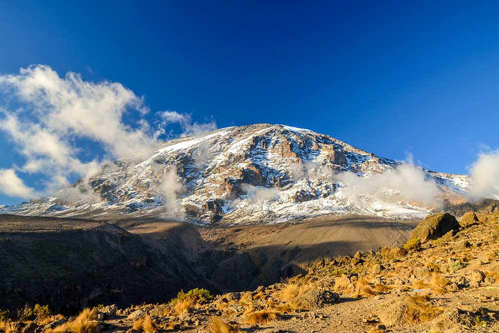
The Lemosho Route is considered one of the best routes on Mount Kilimanjaro due to its excellent acclimatization profile, spectacular scenery, and lower traffic levels. Starting on the remote western side of the mountain, the trail traverse’s pristine rainforest, crosses the vast Shira Plateau, ascends through alpine desert, and culminates at Uhuru Peak the highest point in Africa.
The additional acclimatization day significantly improves summit success rates while allowing trekkers to enjoy a gradual, scenic ascent.
Elevation: 2,100 m → 2,650 m
Distance: ~7 km
Trekking Time: 3–4 hours
Ecological Zone: Montane Rainforest
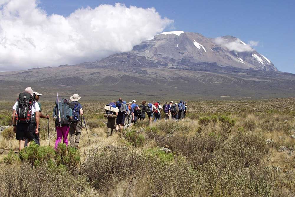
After breakfast in Arusha, transfer to Lemosho Gate (approx. 3 to 4 hours). Upon arrival, complete park registration formalities before beginning your trek.
The trail winds gently through dense, lush rainforest where colobus monkeys, blue monkeys, and a variety of bird species are often seen. The path is well-shaded and gradually ascends through towering trees covered in moss and lichens.
Arrive at Mti Mkubwa “Big Tree” Camp in the afternoon. Your crew will have tents set up and warm drinks ready. Dinner is served in the dining tent followed by a briefing for the next day.
Overnight: Mti Mkubwa Camp
Elevation: 2,650 m → 3,505 m
Distance: ~8 km
Trekking Time: 5–6 hours
Ecological Zone: Rainforest → Moorland
Today you leave the rainforest behind and enter the heather and moorland zone. The trail becomes steeper as you climb a ridge offering your first impressive views of the Shira Plateau and Kibo Peak.
Vegetation changes dramatically, with giant heathers and volcanic rock formations dominating the landscape. On clear days, you may see Mount Meru in the distance.
Arrive at Shira 1 Camp in the afternoon. Temperatures begin to drop as altitude increases, so warm layers are recommended.
Overnight: Shira 1 Camp
Elevation: 3,505 m → 3,850 m
Distance: ~7 km
Trekking Time: 3 t o4 hours
Ecological Zone: Moorland
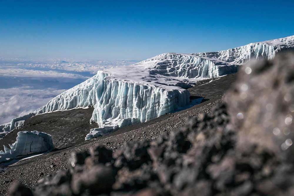
This is a relatively gentle trekking day across the vast Shira Plateau — one of the highest plateaus on Earth. The route offers wide-open landscapes with dramatic views of Kibo’s glaciers.
The slower pace allows your body to adapt to the increasing altitude. Guides monitor oxygen levels and overall health as part of the acclimatization process.
Arrive early at Shira 2 Camp, allowing time to rest or take a short acclimatization walk.
Overnight: Shira 2 Camp
Elevation: 3,850 m → 4,600 m → 3,960 m
Distance: ~10 km
Trekking Time: 6 to 7 hours
Ecological Zone: Moorland, Alpine Desert
Today is a key acclimatization day following the “climb high, sleep low” principle. You ascend steadily toward Lava Tower (4,600 m), a dramatic volcanic rock formation.
The air becomes thinner and the terrain more rugged. After lunch near Lava Tower, you descend into the scenic Barranco Valley, known for its giant senecio plants and towering cliffs.
This descent helps your body adapt to altitude while positioning you well for the days ahead.
Overnight: Barranco Camp
Elevation: 3,960 m → 4,035 m
Distance: 5 km
Trekking Time: 4 to 5 hours
Ecological Zone: Alpine Desert
Begin the day by climbing the famous Barranco Wall a fun and rewarding scramble rather than a technical climb. From the top, enjoy spectacular views of the Heim Glacier.
The trail continues over rolling terrain with several ascents and descents before reaching Karanga Camp. This shorter day enhances acclimatization and conserves energy for summit day.
Afternoon rest and preparation.
Overnight: Karanga Camp
Elevation: 4,035 m → 4,645 m
Distance: ~4 km
Trekking Time: 3/4 hours
Ecological Zone: Alpine Desert
A steady climb leads to Barafu Camp, situated on a rocky ridge. The environment is stark and dramatic, with sweeping views of Mawenzi Peak.
After an early dinner, your guide conducts a detailed summit briefing. Rest is essential as you prepare for a midnight departure.
Overnight: Barafu Camp
Elevation: 4,645 m → 5,895 m → 3,080
Distance: ~15 km
Trekking Time: 10–14 hours
Ecological Zone: Alpine Desert → Arctic → Moorland
Your summit attempt begins around midnight. Moving slowly and steadily, you ascend steep scree slopes under a sky filled with stars.
Reach Stella Point (5,756 m) at sunrise, where you are rewarded with breathtaking views. Continue along the crater rim to Uhuru Peak (5,895 m) the Roof of Africa.
After photos and celebration, descend carefully to Barafu Camp for rest and lunch before continuing down to Mweka Camp in the moorland zone.
This is the longest and most challenging day of the trek.
Overnight: Mweka
Elevation: 3,080 m → 1,640 m
Distance: ~10 km
Trekking Time: 3 to 4 hours
Ecological Zone: Rainforest
A gentle descent through the emerald canopy of rainforest brings you to Mweka Gate, where the journey officially concludes. Here, you’ll be presented with your hard-earned summit certificate a lasting symbol of your achievement. After heartfelt farewells to the dedicated mountain crew who supported you along the way, you’ll board your transfer back to Arusha. The drive offers time to reflect on the adventure, before arriving for a well-deserved rest and celebration of your accomplishment.
Includes
- Camping equipment
- A professional mountain guide
- Professional chef
- Porter team
- Trekking poles
- First aid kit
- Emergency oxygen
- Rescue fees
- Portable toilet
- Park fees & entry fees
- All government taxes
Excludes
- Personal trekking gear
- Tips for mountain crew
- Travel insurance and visa fees
- International
- domestic flights
- Trekking poles
- Accommodation before and after the trek
Your dream Adventure starts here - how would you like to experience Tanzania?
24/7 HOUR AVAILABLE
+255 658 961 496